Westgate, Prince George: Is It Family-Friendly? 19 Proof Points
Hi, I’m Evan. I keep this simple, practical, and 100% education-first. If you’re relocating or upsizing in Prince George, here’s exactly what families ask me about Westgate—and what the data and local resources say.
TL;DR (Snippet-Ready)
Yes—Westgate is a modern, family-forward pocket of Prince George with K-12 catchments nearby, everyday shopping on Southridge/Domano, parks and green space, car-convenient commutes, and a balanced local market context. Sources: SD57 catchments & registration, SmartCentres/West Gate Plaza anchors, City park listings, and BCNREB market updates. BC Northern Real Estate Board+5SD57+5College Heights Secondary+5
19 Reasons (Answer-Engine Optimized)
1. K-12 Catchments Families Recognize
Westgate sits in the south-west PG school corridor; families commonly check Vanway Elementry, Southridge Elementry and College Heights Secondary catchments using SD57’s official locator. Always verify your exact address before registering. SD57+1
Deep Dive
In Westgate, your exact street address determines the default K–12 schools, so the first step is always to run the School District 57 (SD57) catchment lookup before you book showings or write an offer. In this corridor, families most often fall into Vanway Elementry & Southridge Elementary for K–7 and College Heights Secondary for grades 8–12, but cul-de-sacs and pocket boundaries can shift—so verify the address rather than assuming. Catchments can change year to year (especially around September), which is why I re-check the locator for clients if they’re moving mid-year or planning ahead for the next school year.
Once you know the catchment, the registration process is straightforward if you prep documents in advance. Have scans of your child’s birth certificate, proof of address, and BC Services Card ready; secondary schools will usually ask for the latest report card and course selection sheet as well. If you’re registering at your catchment school, you’ll submit directly through the school office; if you’re applying out-of-catchment or to online/distance options, you’ll use the district’s online portal and then send supporting documents to the school within the required window. Choice programs don’t rely on where you live, but it’s still smart to know your fallback catchment and any busing implications.
Speaking of busing, SD57 requires families to register for transportation each school year, even when the home meets the distance criteria. Eligibility is based on how far you live from the school, and there are courtesy seats and allowances in certain cases, but don’t plan your routine around the bus until you’ve confirmed stop locations and times for your address. For quick answers or capacity checks, calling the school secretary is often faster than email; I also keep an eye on board updates in case any boundary adjustments are proposed that might affect the coming year.
My client workflow is simple: I run the address through the SD57 tool, confirm intake and documents with the school office, check bus eligibility/stop distance, and note any pending boundary changes. Then we build a realistic morning plan around bell times, commute, and after-school care. If you share the exact address and your kids’ current grades, I’ll run this stress test for you so you’re school-ready on Day 1.
2. Clear High-School Catchment Boundaries
College Heights Secondary serves areas south of Hwy-16 including College Heights and points west—use the school’s catchment page to confirm. SD57+1
Deep Dive
College Heights Secondary generally serves homes south of Highway 16, covering the College Heights and Upper College Heights corridor and extending west toward rural pockets—so if your Westgate address sits on the south side of Hwy-16, CHSS is typically the default high school. The quickest way to be sure is to run your exact street address through School District 57’s “Find a School” lookup; that tool gives you both elementary and secondary assignments and avoids guesswork from listings or third-party maps. Because enrolment can tighten, especially heading into September, it’s smart to verify two things early: that your address is indeed in the CHSS catchment and that the school has space for the upcoming term.
If you’re out-of-catchment or live on a boundary street, you can apply to attend CHSS, but approval isn’t guaranteed—so keep your catchment school as a backup and follow the district’s registration steps (proof of address, birth certificate, BC Services Card, and any grade-specific forms like course selection). Transportation follows catchment as well: eligibility depends on distance, and even if you qualify you’ll still need to complete the district’s online bus registration each school year. When clients ask me to “stress-test” a Westgate address, I run the SD57 lookup and save it, call the CHSS office to confirm current capacity, check bus eligibility and nearest stop locations, and then map real-world morning logistics (drive time, bell schedules, and after-school plans) so the decision is clear and practical.
3. Quick Grocery + Big-Box Errands on Southridge Ave
SmartCentres Prince George (6565 Southridge Ave) clusters day-to-day needs—an easy “errand loop” for busy households. Waze+1
Deep Dive
If your week is a blur of groceries, school supplies, sports gear, and “we-need-it-tonight” fixes, Westgate’s Southridge/Domano corridor is built for one-trip efficiency. The centre of gravity is SmartCentres Prince George at 6565 Southridge Avenue—a large-format retail node where you can stack multiple stops without criss-crossing town. The developer’s site plan lists a broad tenant mix (from apparel to services and food options), and—most important for busy households—it sits right where Hwy-16 W meets Domano Blvd, so getting in and out is painless. SmartCentres
Just down on Domano Blvd, you’ve got the everyday staples most families hit weekly: Save-On-Foods at 5232 Domano Blvd for the main shop (with online ordering/curbside if you want to time-box your errand run), plus Canadian Tire at 5008 Domano Blvd for seasonal gear, car bits, and house hardware. That pairing alone covers a surprising amount of “life admin.” MapQuest+1
For home-improvement weekends or the inevitable “we’re missing one fitting” moment, The Home Depot serves the south side from 5959 Dakelh Ti / O’Grady Rd—close enough to keep a reno day on schedule. Because it’s on the same side of town as Westgate, you avoid a long cross-city detour mid-project. Home Depot+1
If you’re trying to give teens some independence, the BC Transit Route 16 (UNBC/College Heights) runs the Domano corridor with timing points around McGill & Domano and Domano & Malaspina—handy for quick trips to the Domano/Southridge cluster after school. I still recommend checking the current stop placement and schedules, but the map shows clear coverage through the College Heights/Westgate area. BC Transit+1
The net effect: a compact, car-convenient “errand loop.” Start at SmartCentres for multi-stop shopping, swing along Domano for Save-On-Foods and Canadian Tire, and keep Home Depot slotted for project days—then hop right back onto Hwy-16. The City’s official street map also makes it easy to learn the cul-de-sacs feeding out to these arterials (Westgate Ave/Place/Court, Westmount, Westridge), so you can choose a home base that matches your errand habits. PG Map Info
Want me to tailor an errand map to your exact address (drive times, left-turn pain points, school bell windows)? Send the address and your typical weekly stops; I’ll map a “fast loop” that saves time every single week.
4. Domano Blvd Convenience Strip
West Gate Plaza on Domano Blvd plus nearby pads (Save-On-Foods, pharmacies, QSRs) give you weeknight convenience without trekking across town. MapQuest+1
Deep Dive
Start with the anchor pair: Save-On-Foods at 5232 Domano Blvd for the main grocery run (with pharmacy on site) and Canadian Tire at 5008 Domano Blvd for seasonal gear, household hardware, and the auto centre. Those two addresses—barely a minute apart—cover most “we need it tonight” errands without crossing town. MapQuest+3Yelp+3OATRx+3
Zooming out a touch, Domano connects directly to the bigger Southridge node at SmartCentres Prince George, 6565 Southridge Ave—so if groceries turn into a multi-stop evening, you can loop between Domano and Southridge without detours. The SmartCentres site and mapping apps list the centre at the Hwy-16 W / Domano junction, which is why in-and-out traffic tends to be painless even at peak after-school hours. SmartCentres+2Waze+2
For project days (or the inevitable missing fitting), The Home Depot at 5959 Dakelh Ti (O’Grady Rd area) sits on the same side of town as Westgate. Keeping reno runs south saves time—especially when you’re juggling kid pick-ups with a parts dash. Home Depot+2Home Depot+2
If you’re coaching independence for teens, Domano is also transit-friendly: BC Transit Route 16 (UNBC/College Heights) and Route 19 UNBC/Westgate service the corridor, so older kids can bus to the Domano/Southridge cluster after school. Always check the current schedules, but having both routes pass through the area makes quick, car-free errands realistic. BC Transit+2Transit+2
Net-net: Domano Blvd acts like a “weeknight convenience spine.” You grab groceries and pharmacy items at Save-On-Foods, sort sports/house gear or a flat tire at Canadian Tire, bounce to SmartCentres if the list grows, and keep Home Depot slotted for project days—all within a compact loop that’s easy to reach from Westgate’s cul-de-sacs. Home Depot+3Yelp+3Canadian Tire+3
5. Dedicated City Park: Westgate Park
The neighbourhood has a namesake park (3703 Hwy 16) and broader access to PG’s park network for playgrounds, dog time, and weekend hangs. City of Prince George+1
Deep Dive
Westgate Park is the namesake green space serving the Westgate/Upper College Heights pocket, and the City lists it at 3703 Hwy 16—handy because it sits near the main Southridge/Domano shopping axis and Hwy-16 for quick drop-ins before or after errands. The official park page confirms the location and provides City contact details for maintenance or bookings, while the broader Our Parks & Playgrounds hub shows how Prince George categorizes sites (neighbourhood, community, nature, parks with playgrounds/washrooms, pet-friendly). That directory is useful if you want to plan age-specific outings—e.g., confirm which nearby parks guarantee washrooms for potty-training years, or where dogs are explicitly welcome—then add Westgate Park as your close-to-home default. City of Prince George+1
If you’re building a weekend rhythm, use PGMap or the City’s Open Data – Park & Open Spaces layer to see the park boundary, nearby trails, and how your street network connects to it on foot or by bike. That’s especially helpful when comparing cul-de-sacs: some blocks feed to green space with only one street crossing; others require popping out to Domano or Hwy-16, which changes “quick play” feasibility with strollers or scooters. Power users: save a personal map with your most-used routes and add school/errand stops to visualize a realistic weekday loop. Prince George Maps+1
For families who like variety, the City’s park listings make it easy to “graduate” to bigger destinations (playground upgrades, athletic fields, nature parks) without abandoning the Westgate base. In practice, most clients lean on Westgate Park for spontaneous after-dinner runs and weeknight energy dumps, then branch out to premier or nature parks on weekends. Keep the City’s parks hub bookmarked to check seasonal notes, amenity filters, and any maintenance advisories. City of Prince George+1
If you want, send me your exact street and kids’ ages—I’ll map the safest walking route to Westgate Park plus two “rainy-day backup” parks with washrooms or covered options, and I’ll layer in your errand loop so everything fits a 60-minute window.
6. Green-Space Options Beyond the Block
Families spread out to city “premier” parks like Lheidli T’enneh Memorial Park and nature parks for biking and picnics. City of Prince George+1
Deep Dive
When you’re ready for more than a quick cul-de-sac play, Westgate families have a trio of easy “weekend green” options. Lheidli T’enneh Memorial Park is the flagship riverfront space with paved paths, big lawns, and frequent community activity—perfect for strollers, scooters, and a guaranteed hour of movement without worrying about mud. Forests for the World delivers the opposite vibe: shaded loops, lakeside boardwalk moments at Shane Lake, and enough trail variety to right-size a walk for toddlers or teens. Dog families tend to default to Ginter’s Meadow, where the interior is off-leash and the perimeter connects to the UNBC trail system, so you can extend the outing when everyone still has energy.
Picking the right spot is simple: if you’ve only got an hour, Lheidli’s paved network is the most reliable choice; if you need shade and a “we’re in the woods” feel, Forests for the World is your best bet; if the dog needs a real run, start at Ginter’s and cool down on the on-leash perimeter. City park rules are straightforward—think 6 a.m. to 11 p.m. unless posted otherwise—and washrooms at many parks are seasonal, so it’s worth checking before you promise a bathroom stop mid-play. Pet etiquette follows common sense: off-leash only where signed, and assume on-leash near playgrounds and fields.
For planning, build a simple weekend loop: stack an errand or two on Southridge/Domano, spend 60–90 minutes at Lheidli or Forests for the World, then grab dinner nearby. Save two weather-proof backups in your phone—a paved option (Lheidli) and a nature option (Forests for the World)—so you don’t lose outdoor time to rain. If you’ve got a dog, keep a towel in the trunk and expect a little meadow mud after rain at Ginter’s. If you want, share your street and your kids’ ages (plus whether you have a dog) and I’ll map a quick, personalized 90-minute circuit with parking, safest crossings, and rainy-day backups so you can just load up and go.
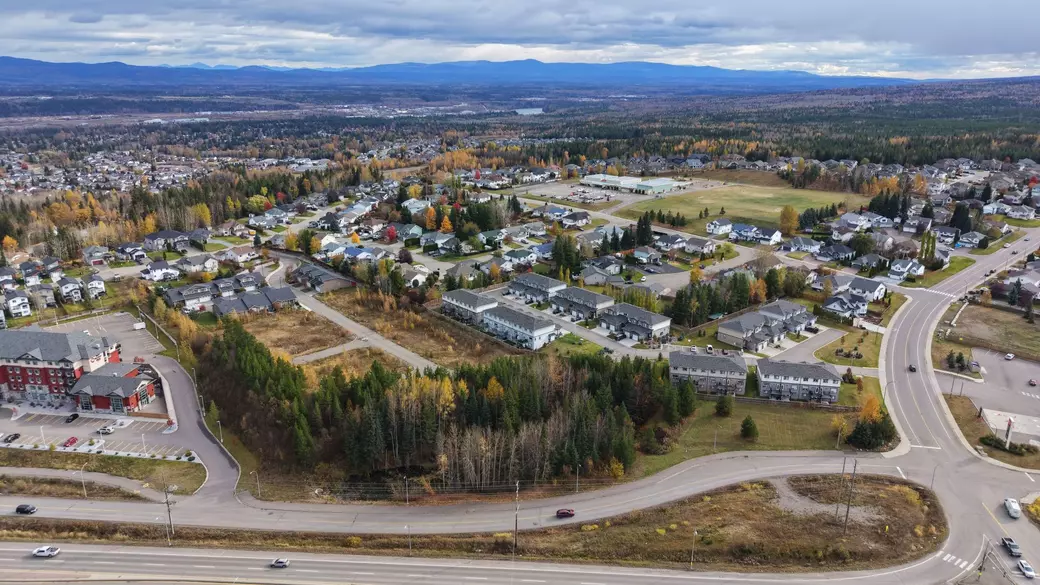
7. Car-Convenient Layout
A sample Westgate address shows a “Car-Dependent” Walk Score—most errands are still easy, but by car. Plan for garage/mudroom life. Walk Score
Deep Dive
Westgate lives up to its reputation as “car-convenient.” The Domano/Southridge corridor that serves the neighbourhood consistently scores in the car-dependent range on Walk Score—think quick, efficient driving for most errands rather than true walkability. For example, Domano Boulevard posts an estimated Walk Score ~30 (“Car-Dependent”), while nearby Southridge Ave addresses sit around the low-40s; both signal that groceries, hardware, pharmacy, and kid shuttles are all easiest by car, with sidewalks and crosswalks supporting shorter on-foot hops where it’s practical. Walk Score+1
Why that works for families: the street grid in and around Westgate is a web of crescents and cul-de-sacs that feed directly to the two main arterials—Domano Blvd and Southridge Ave—and then quickly out to Hwy-16 W. That design keeps through-traffic low on interior streets (nice for bikes and driveway basketball) while making exits to shopping clusters and school runs straightforward. You can see the Westgate Ave/Place/Court cluster and adjoining streets on the City’s official street map if you want to compare how each pocket connects to the arterials. PG Map Info
Commute and errands feel predictable because the arterial → highway handoff is simple: Domano/Southridge link directly to Hwy-16, and your primary weekly loop—SmartCentres on Southridge plus Domano staples—sits right on that spine. Even if you’re mixing a grocery run with a hardware stop and a pharmacy pickup, you’re typically stringing those stops on one line rather than zig-zagging across town. (Transit is present, but supplemental: BC Transit Route 16 (UNBC/College Heights) runs through the corridor—useful for teens or a car-light household—yet the built form still biases most families to drive.) BC Transit
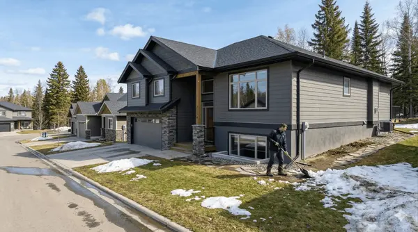
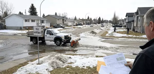
Winter reality check: Prince George plows and sands arterials first, then residentials, using a priority system. After a snow event that meets the City’s threshold, Priority 1–2 routes target clearing within 48 hours, with Priority 3 (most residential streets) following within 72 hours—so plan your week expecting arterials to be passable sooner than cul-de-sacs. Pair that with standard BC winter prep—proper winter tires and an in-car kit—and you’ll keep the “car-convenient” advantage even in shoulder seasons. City of Prince George+2City of Prince George+2
Bottom line: Westgate is engineered for efficient, car-first daily life. You get calm interior streets at home and fast access to everything along Domano/Southridge and Hwy-16 when you roll out—exactly the combo most families ask for when they say “we’re busy; we just need the errands to be easy.” If you want, send me your exact street and typical stops; I’ll map the fastest 45-minute errand loop (left-turns, school windows, winter alternates) so you can pressure-test the fit before you buy.
8. Transit Touchpoints
If you want the bus for teens, the 16 College Heights line services the area near West Gate Plaza; check current stop distances and times. Moovit
Deep Dive
While Westgate is designed for easy driving, public transit along Domano/Southridge is a useful backup—especially for teens gaining independence or when you’re running a one-car household. Practically, you’ll find stops clustered on Domano near the West Gate Plaza spine and along Southridge toward the big-box node; those cover after-school snack runs, quick pharmacy trips, and part-time job commutes without a parent taxi. The playbook is simple and evergreen: check BC Transit’s Prince George site for the latest route map and live departure times, then line them up with school bell schedules so kids aren’t waiting in winter wind. Show your student how to read the stop ID, where to stand for the return direction (easy to mix up on divided roads), and how to use the bus’s front bike rack when spring hits. In snowy spells, assume minor delays and dress for a longer wait; when it’s icy, pick the stop with the safest crossing instead of the closest. For evenings, choose well-lit stops near storefronts, and build a “Plan B” (rideshare or a family pickup window) if the last bus is missed. Even if you mostly drive, having the transit option dialed-in—stop locations, real-time app, and a stored pass—gives your household flexibility on school days, shift work, and those inevitable “practice ran late” texts.
9. Street Grid That Favors Cul-de-Sacs
City mapping shows a network of crescents/places (e.g., Westgate Ave/Place/Court), which helps with lower through-traffic on many pockets. PG Map Info
Deep Dive
Westgate’s interior streets are mostly crescents, places, and short courts that dead-end or loop back to Domano/Southridge, which naturally curbs through-traffic and creates that “kids on bikes, driveway hoops, evening dog walks” vibe families want. Day to day, this means slower average speeds, easier curbside parking, and less honking/engine noise—but it also means you’ll do short in-and-out drives for nearly every errand (a trade-off most parents happily make). When you’re comparing listings, do a quick “street test”: drive the block during school drop-off and after-work windows; check where snow windrows pile after plows (cul-de-sacs collect more, so confirm turnaround space and where you’ll stash bins on garbage day); note street lighting and sightlines if kids ride after dusk; and listen for highway hum if the court backs greenbelt toward Hwy-16. On a map, crescents closest to Domano give you the fastest errand exits, while deeper cul-de-sacs feel quietest—pick based on your tolerance for left turns at peak times. Corner lots add parking and yard light but get more snow splash; mid-block lots feel most private. If teen independence is a goal, choose pockets with a short, sidewalked walk to the nearest bus stop on Domano or Southridge; if stroller life rules, prioritize continuous sidewalks and gentle grades back to your door. Bottom line: the cul-de-sac heavy grid is the secret sauce behind Westgate’s calm—just match the exact pocket to your routine so you keep the quiet without adding friction to busy weeks.
10. Balanced-But-Active Market Context (2025)
BCNREB’s recent updates show healthy regional activity and improving dollar volume; use board stats to frame timing and offer strategies. BC Northern Real Estate Board+1
Deep Dive
Westgate behaves like a balanced market that still rewards the most organized players—think steady listing flow, quick movement on “turn-key family” homes, and fewer true bidding wars than bigger BC centres, but little patience for properties that feel overpriced or under-prepared. As a buyer, set a 90-day buy box (price band, min 3-bed/2-bath, driveway fits two, fenced yard, preferred pocket) and comp by street pocket rather than postal code; cul-de-sacs, south-exposure backyards, and flat driveways routinely earn premiums that broad averages miss. Do a two-tier offer strategy: Tier A (clean inspection → full number you’re happy to own at) and Tier B (minor findings → a pre-decided reduction or seller credit), so you’re decisive without re-negotiation drama. Pre-book an inspection window with a flexible firm and keep proof of funds + deposit liquid—being ready 24–48 hours earlier than the next family is often the entire difference. For sellers, the leverage is prep: a pre-list inspection to surface northern-common items (attic ventilation/ice-damming, grading/drainage paths, roof age, furnace service, sump/weepers), then fix the cheap/high-impact ones and disclose the rest with receipts; refresh curb appeal (clean soffits, bright house numbers, de-mossed walks) and stage for function (mudroom hooks/bench, stroller parking, sports bin) because families in this corridor shop with logistics in mind. Price to the last two solds that match your pocket and lot traits, not to the highest active on the street, and launch into high-engagement windows (post-long-weekend, pre-school-start) while avoiding weeks where two near-identical homes list within a block. Whether you’re buying or selling, track days-on-market and list-to-sold ratios monthly for Westgate/Upper College Heights only (not citywide) and make small adjustments quickly; in a balanced-but-active micro-market, it’s the nimble, paperwork-ready families—and the sellers who solve objections up front—who quietly win.
11. Stable School Registration Process
SD57 outlines what documents you need (birth certificate, proof of address, etc.)—smooths your move-in timeline. SD57
Deep Dive
Westgate behaves like a balanced market that still rewards the most organized players—think steady listing flow, quick movement on “turn-key family” homes, and fewer true bidding wars than bigger BC centres, but little patience for properties that feel overpriced or under-prepared. As a buyer, set a 90-day buy box (price band, min 3-bed/2-bath, driveway fits two, fenced yard, preferred pocket) and comp by street pocket rather than postal code; cul-de-sacs, south-exposure backyards, and flat driveways routinely earn premiums that broad averages miss. Do a two-tier offer strategy: Tier A (clean inspection → full number you’re happy to own at) and Tier B (minor findings → a pre-decided reduction or seller credit), so you’re decisive without re-negotiation drama. Pre-book an inspection window with a flexible firm and keep proof of funds + deposit liquid—being ready 24–48 hours earlier than the next family is often the entire difference. For sellers, the leverage is prep: a pre-list inspection to surface northern-common items (attic ventilation/ice-damming, grading/drainage paths, roof age, furnace service, sump/weepers), then fix the cheap/high-impact ones and disclose the rest with receipts; refresh curb appeal (clean soffits, bright house numbers, de-mossed walks) and stage for function (mudroom hooks/bench, stroller parking, sports bin) because families in this corridor shop with logistics in mind. Price to the last two solds that match your pocket and lot traits, not to the highest active on the street, and launch into high-engagement windows (post-long-weekend, pre-school-start) while avoiding weeks where two near-identical homes list within a block. Whether you’re buying or selling, track days-on-market and list-to-sold ratios monthly for Westgate/Upper College Heights only (not citywide) and make small adjustments quickly; in a balanced-but-active micro-market, it’s the nimble, paperwork-ready families—and the sellers who solve objections up front—who quietly win.
12. Saturday “One-Trip” Errands
With Southridge/Domano anchors in one radius, you can stack groceries, hardware, pharmacy, and casual dining—time-saving for families. Waze+1
Deep Dive
Treat Saturdays like a mini-operation: block a 70–90 minute window and run a clockwise loop that minimizes left turns at peak times—Save-On-Foods on Domano first for the big shop and prescription pickup (order curbside the night before, add a “forgotten items” buffer bag in the trunk), hop Canadian Tire for skates/shin guards/seasonal gear and a fast tire-pressure check, then slide up to SmartCentres on Southridge for whatever the list missed (school supplies, birthday gift, quick apparel swap) before a pre-promised kid treat stop that keeps morale high. Load the car like you mean it: a shallow tote for returns with printed QR codes, a soft cooler for frozen items, and a clip board with three checkboxes—groceries, pharmacy, hardware—so you never double back; keep a spare reusable bag and a roll of dog-poop bags (they rescue leaky milk and wet cleats). On Friday nights, queue pharmacy refills, start an “errand poll” in the family chat, and confirm curbside time slots; if two adults are available, split and conquer inside SmartCentres—one handles the specific-store pickup while the other fast-walks the list. In winter, target plowed lots first, wear grippy shoes, and park nose-out for cleaner exits; in summer, put the grocery stop either first (for cold-chain in the cooler) or last (if you’ll linger at a park). Teens can ride Route 16/19 on Domano/Southridge to meet you for the last store, practice “return-line” etiquette, and learn to scan a receipt for wrong prices before you leave. Cap the loop with a five-minute trunk reset at home—returns bin back in place, cooler refrozen, tote reloaded with tape and scissors—and you’ll find the rest of Saturday is yours again; the compound time savings over a month is enormous, and the predictable rhythm means fewer midweek “we’re out of…” emergencies.
13. Neighbourly Vibe (Community Groups Help)
Local community groups keep residents plugged into lost pets, events, and school notices—useful for newcomers to learn the rhythms. Facebook
Deep Dive
The reason Westgate reads “family-forward” isn’t just cul-de-sacs—it’s the way micro-communities form around schools, sports, and short errand loops. Treat your first month like onboarding: introduce yourself to the three nearest homes (names + numbers on a shared contact card), join the school PAC email list and team chats, and follow the City parks + road updates so you can swap useful intel (which corners ice first, when windrows get cleared, which park dries out fastest after rain). Start a lightweight mutual-aid thread with two neighbours for “SOS” moments—borrowed eggs at 8 p.m., a last-minute sitter lead, jumper cables in February—and offer something simple back (you have a ladder, an air compressor, or you’re happy to grab a pharmacy pickup on your loop). For kids, set a green-light zone (which cul-de-sacs, which park route, home-by time) and teach a shared “check-in text” so older ones can roam responsibly; for seniors next door, a “porch glance” routine after snowfalls or heat waves builds real safety without being intrusive. If you’re game to seed community, organize a tiny driveway meetup—30 minutes, hot chocolate, name stickers—or a seasonal gear swap where outgrown skates and shin guards find a second life. Keep a running “neighbour log” on your phone (names, pets, kids’ ages, helpful notes like “night shift”) so you can be thoughtful—quiet hours respected, packages rescued, dog gates latched. The compounding effect is huge: rideshares to practice appear, curbside tools circulate, lost-and-found returns itself, and your street becomes the kind of place where a power outage turns into a candlelit board-game night rather than a scramble. In short, a tiny bit of intentionality turns friendly blocks into a genuine support net—and that’s the secret sauce behind why Westgate feels so easy to live in.
14. Multiple Housing Types
Westgate/Upper College Heights corridors mix single-family, townhomes, and commercial edges—good laddering for first homes or downsizers. LoopNet
Deep Dive
Westgate/Upper College Heights is one of those rare pockets where you can grow—or right-size—without abandoning your school network, errand loop, or community ties. The mix is deliberate: townhomes and compact singles closer to collectors for entry-level price points; larger single-family homes tucked onto crescents and cul-de-sacs for the stroller-and-scooter years; and a light commercial edge that keeps weeknight errands under an hour. If you’re early in the journey, target townhomes with efficient mudroom space, a real pantry, and a garage deep enough for bikes plus a push mower—those small wins extend the home’s usefulness by years. When you’re trading up, families here consistently pay premiums for flat, two-car side-by-side driveways (hockey pickups at 6 a.m. are real), fenced rectangular backyards you can supervise from the kitchen, and main-floor utility—a powder room near the entry, a drop zone for backpacks, and sightlines to the play area. If resale is on your mind, prioritize quiet interior pockets; cul-de-sacs with minimal through-traffic photograph and show beautifully and tend to hold value when markets wobble. For investors or multi-gen households, scan for suite-friendly lower levels (proper egress, sound separation, parking that doesn’t choke the court), and for aging-in-place plans, look for a bedroom and full bath on the main plus wide hallway clearances—you’ll thank yourself later. Inside the home, pick finishes that play well with Prince George seasons: durable flooring at the entry, washable paint, and storage for winter gear; outside, check for hose bibs, sunny yard orientation, and manageable snow routes. The larger idea is simple: with Westgate’s variety, you can start modest, climb to your “forever layout” when life expands, and eventually right-size again—all without resetting your daily rhythm of schools, parks, and Domano/Southridge errands. That continuity is a huge quality-of-life multiplier and a quiet wealth builder, because each move happens inside a neighbourhood buyers already understand and want.
15. Proximity to Hwy-16
Domano/Hwy-16 access shortens cross-city drives and weekend getaways compared with more central, light-controlled routes. LoopNet
Deep Dive
Living minutes from Hwy-16 is Westgate’s quiet superpower: your weeknight pattern becomes cul-de-sac → Domano/Southridge → Hwy-16 → destination, which strips out a lot of light-to-light friction and makes ETAs predictable for school pickups, rink slots, Costco runs, and weekend getaways west or into town. In practice, you’ll chain errands in a single line—Save-On/Canadian Tire on Domano, SmartCentres on Southridge, quick hop to Hwy-16—without zig-zagging across the city. To keep stress low at busy times, pick a pocket that lets you right-turn out to the arterial and loop back rather than forcing a left across peak traffic; the same trick shines in winter when plows leave windrows at court mouths. If noise is a concern, walk the block at rush hour and during a windy afternoon to sample any highway hum; lots backing greenbelt that faces Hwy-16 can be louder on gusty days, while deeper crescents feel notably quieter. For safety and speed, learn two routes to the highway (primary + storm/school-zone alternate), and in snow season run winter tires, windshield fluid, and a “storm kit” so a quick dash stays quick. Parking nose-out in cul-de-sacs, favoring lots with flat two-car driveways, and pre-planning left-turn avoidance at known choke points (e.g., timing lights on Southridge) will keep your “car-convenient” edge intact all year. The net result is more minutes actually moving and fewer stuck negotiating intersections—which is exactly what busy families mean when they say Westgate “drives well.”
16. Youth Independence Options
Transit + plaza proximity give teens some autonomy (bus to West Gate Plaza; walkable pockets), while most chores remain car-based. Moovit
Deep Dive
Westgate makes teen autonomy surprisingly doable because the destinations they actually need—groceries for a last-minute ingredients run, quick-serve with friends, part-time jobs—sit right on the same Domano/Southridge spine that carries transit. Set them up with a three-part toolkit: (1) Transit fluency—install the local app, save stop IDs in Notes, practice reading the return-direction stop (easy to mix up on divided roads), and agree on a simple “missed last bus” Plan B with a firm text-by time; (2) Bike confidence—choose routes that trade “shortest” for simplest crossings, add lights and a lock, and set a daylight-only rule until they demonstrate solid route judgment; and (3) Money & micro-planning—give them a low-limit debit card or prepaid wallet, teach receipt checks before leaving the store, and set a two-message protocol (“arrived” + “leaving”) so you aren’t guessing. Wrap that with seasonal skills: in winter, pick the safest stop over the closest, build a “10-minute wait kit” (gloves, toque, portable charger), and swap to boots with real tread; in shoulder seasons, a compact rain layer lives in the backpack. If they’re working at the plazas, have them screenshot weekly shifts and bus times into a shared family calendar, and pre-walk the darkest segments together to identify the well-lit path that hugs storefronts. Add small independence “wins” early—solo pharmacy pickup, school-supply dash, grocery top-up—then graduate to multi-stop errands; the confidence (and time you get back) compounds fast. The goal isn’t to ditch the car; it’s to give your teen clear playbooks so everyday movement is safe, predictable, and parent-light—exactly what keeps family logistics sane in a car-forward neighbourhood like Westgate.
17. Parks for All Ages
City listings categorize parks by amenities (playgrounds, washrooms, athletic): useful for planning with strollers or seniors. City of Prince George
Deep Dive
Make Westgate Park your default “energy dump” for weeknights—close, simple, and easy to bolt onto the Domano/Southridge errand loop—then keep two ready backups so weather never cancels outside time: a paved/stroller-friendly choice (Lheidli T’enneh Memorial Park) and a shade-and-trails choice (Forests for the World). Build a 60–90 minute routine you can run on autopilot: five-minute gear check at the door (layers, water, snack, dog bags), a pre-agreed treat stop to keep kids motivated, and a “one photo, one trash pickup” family habit so even short outings feel purposeful. For toddlers, prioritize parks with visible sightlines from benches and short loops you can bail on; for grade-schoolers, add a mini-challenge (scavenger list, step count, scooter circuit); for teens, tie park stops to a task—shoot hoops, run intervals, or walk the dog while a sibling’s practice is on. In winter, keep traction cleats and a thermos in the trunk, choose routes with plowed paths and lighting, and set a hard “warm-up break” at the 20-minute mark; in shoulder seasons, pack a lightweight rain shell and default to paved loops after storms to avoid mud-soaked morale killers. Dog families: slot Ginter’s Meadow for true off-leash runs, but assume on-leash near playgrounds and fields—teach kids to spot signage so rules stick. Finally, bookmark the City’s park updates for seasonal washrooms and maintenance notes, and save two “backup parks” by name in your phone so there’s no debate at the door. The point isn’t perfection; it’s a simple, repeatable playbook that gets everyone outside fast—because consistent, low-friction green time is what turns a busy week into a better one.
18. Easy Orientation Tools
The City’s PGMap and printable street map make it simple to learn cul-de-sacs, trails, and boundaries before you buy. Prince George Maps+1
Deep Dive
Before you even book showings, spend 10 minutes building a “life map” so you can feel how each Westgate address will actually live. Drop pins for the essentials—your school(s), Westgate Park, Save-On-Foods, Canadian Tire, SmartCentres on Southridge, your clinic/pharmacy, and your most-used sport venues—then add the nearest two bus stops and label them with their stop IDs. Trace the route from the listing’s cul-de-sac to Domano/Southridge and then to Hwy-16; star pockets that allow right-turn exits at peak times and note any left-turn choke points you’d face twice a day. Toggle sidewalk/trail layers and look for sidewalk gaps that turn a five-minute walk into a winter slog; draw two circles from the front door (400 m and 800 m) to see what’s a true stroll vs. a car errand. Switch to satellite + street-view at the lot line: check fence conditions, driveway slope, and whether there’s a collector road lurking behind the greenbelt. Add a quick time–distance matrix in your notes (morning drop-off → errands → home; evening practice shuttle) and run it at two real times—school bell window and early evening—to catch timing friction you won’t feel at noon. In winter, map a storm alternate (avoid steep grades/left turns) and label where city plows tend to windrow; in shoulder seasons, note which park routes are paved for rain days. For sun and privacy, eyeball the yard’s orientation (south-facing yards win for play + gardening), mark any second-storey overlook from neighbours, and listen for highway hum during a breezy afternoon drive-by. Finally, score each shortlist home 1–5 on five lifestyle traits: errand loop simplicity, school access/catchment fit, park access, traffic exposure, and winter routing; homes that stack 4s and 5s are the ones that keep your calendar—and sanity—intact. Export screenshots to a one-pager for each address (older family members appreciate a printable), and you’ll make offers with the confidence that the map—and the week—are on your side.
19. Future-Proof for School Changes
SD57 periodically adjusts catchments. Before writing an offer, re-check the locator and any announced updates for the coming year. My Prince George Now
Deep Dive
If you’re buying “for the school,” lock in a routine that assumes boundaries and capacity can shift. The day you’re serious about a Westgate address, run the district’s catchment lookup for the exact street, then call the elementary and secondary offices to confirm current capacity by grade and whether any boundary reviews are in play; jot names, dates, and what was said in a note you can forward to your file. Build a light contingency tree before you write: Plan A (assigned catchment school), Plan B (nearest viable alternative with open seats), and Plan C (temporary placement + busing/drive plan), so a late-summer tweak doesn’t derail childcare or work. If you have multiple kids, verify sibling placement rules—the goal is keeping everyone in the same building when reasonable—and ask whether mid-year entrants follow different intake windows. During subjects, register at the catchment school now (even if you might apply out-of-catchment) and submit transportation forms so a bus seat is reserved; it’s easier to release a seat than scramble for one. Two weeks before subjects remove, re-do the lookup, reconfirm capacity, and screenshot both results so you have a paper trail. If you’re closing near September, set an early-August reminder to repeat the process, verify bell times, and confirm bus stop locations (stops can shift with ridership); also confirm any choice program or ELL/IEP appointments that need early booking. Finally, embed your plan into daily life: add the school office email and 24-hour attendance line to your contacts, print your route to the school and storm-day alternate, and save a one-page “first week” checklist (meet teacher, pick up timetable, bus tag, medical alerts). Five disciplined touches—lookup, call, register, reconfirm, and document—turn catchment uncertainty into a controlled variable and keep your September calm.
What It’s Like Day-to-Day (Short Story in Your Realtor’s Voice)
Morning drop-offs hit Southridge/College Heights depending on your address, then it’s a 5–10 minute swing through Southridge Ave for groceries, pharmacy, or a hardware run. After work, kids can blow off steam at Westgate Park or head to a bigger city park on weekends. Most families drive for efficiency, but older kids can bus to the Domano/Southridge cluster. That combo—catchments, convenience, cul-de-sacs—is why Westgate keeps landing on “family-friendly” lists. City of Prince George+3SD57+3College Heights Secondary+3
Buyer Tips (Save-This-List)
- Check the exact catchment for your offer address with SD57’s locator. SD57
- Time your showings around school and commuter windows to sample traffic.
- Map your errand loop (Southridge + Domano) and confirm pharmacy/grocery hours. Waze
- Ask about park access within 5–10 minutes of your target street. City of Prince George
- Verify any 2024-25+ catchment updates if school placement is non-negotiable. My Prince George Now
Bottom Line
If you want schools close, errands closer, and a calm street feel, Westgate is built for family life. When you’re ready, I’ll help you stress-test the address against catchment, commute, and lifestyle—before you spend a dollar.
Categories
Recent Posts